The modern county of Cambridgeshire has subsumed Huntingdonshire on its western side, and gained the Soke of Peterborough to the north west from Northamptonshire, now representing a far greater area than it did in the time of the Saxon kings.
The largest land type by area in Cambridgeshire is Fen, either the Peat Fen of the central area formed over the last two thousand years from decaying vegetation, or Silt Fen, where the rivers and the sea keep the land permanently wet. Although the fens have mainly been drained now, some areas remain which are almost exactly the same as in the time of the Vikings, but not all of this land has always been fen - in Roman times, canals were built to drain the land, and for several hundred years the periphery of the fens was productive and supported farms, but with the departure of the Romans in the C5th, the canals were not maintained, and as a result they silted up or became blocked, and the land again became wet, and remained in this state until the large-scale drainage works of the C17th, when much of the fenland was reclaimed for farming.
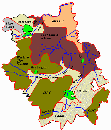
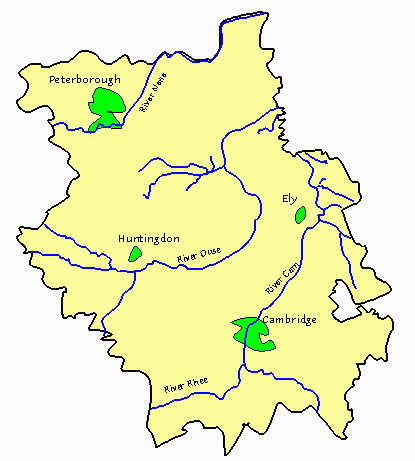
The map above shows the varying soil types found in the modern county of Cambridgeshire, the main modern settlement areas, and the major rivers in the county. The red outlines delimit the land types, and rivers are shown in blue.
Despite its reputation for being flat, Cambridgeshire does have some hills in the south of the county, where clay plateaus and a chalk ridge rise above the gravel soil of the river courses to a height of 150 metres in places. Along these runs the ancient Icknield Way, a road of sorts which dates from the Iron Age or before, and it is clear that it is only along this ridge that travel over any distance was possible without encountering the problems of river and stream, dense forest, fen and marsh which waited below. Other areas of high ground remain in the fenland, where once they stood as islands in a sea of marsh and reeds.